Image

AgWeatherNet (AWN) is a valuable resource that supports agriculture in Washington State by providing weather data and decision-support tools to support production, efficiency, and profitability while also promoting environmental sustainability. AWN plays a crucial role in helping farmers, gardeners, researchers, and policymakers make informed decisions related to weather and agriculture.
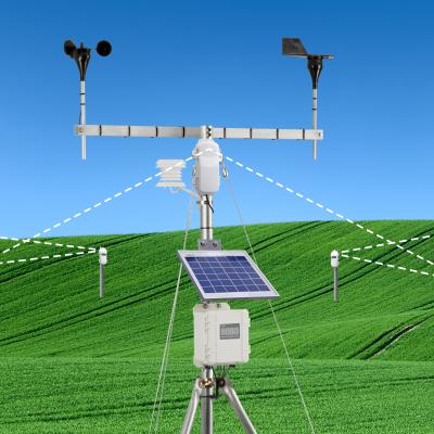
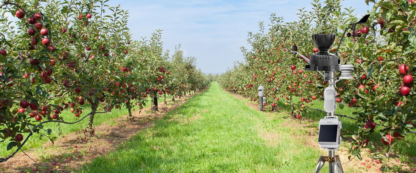
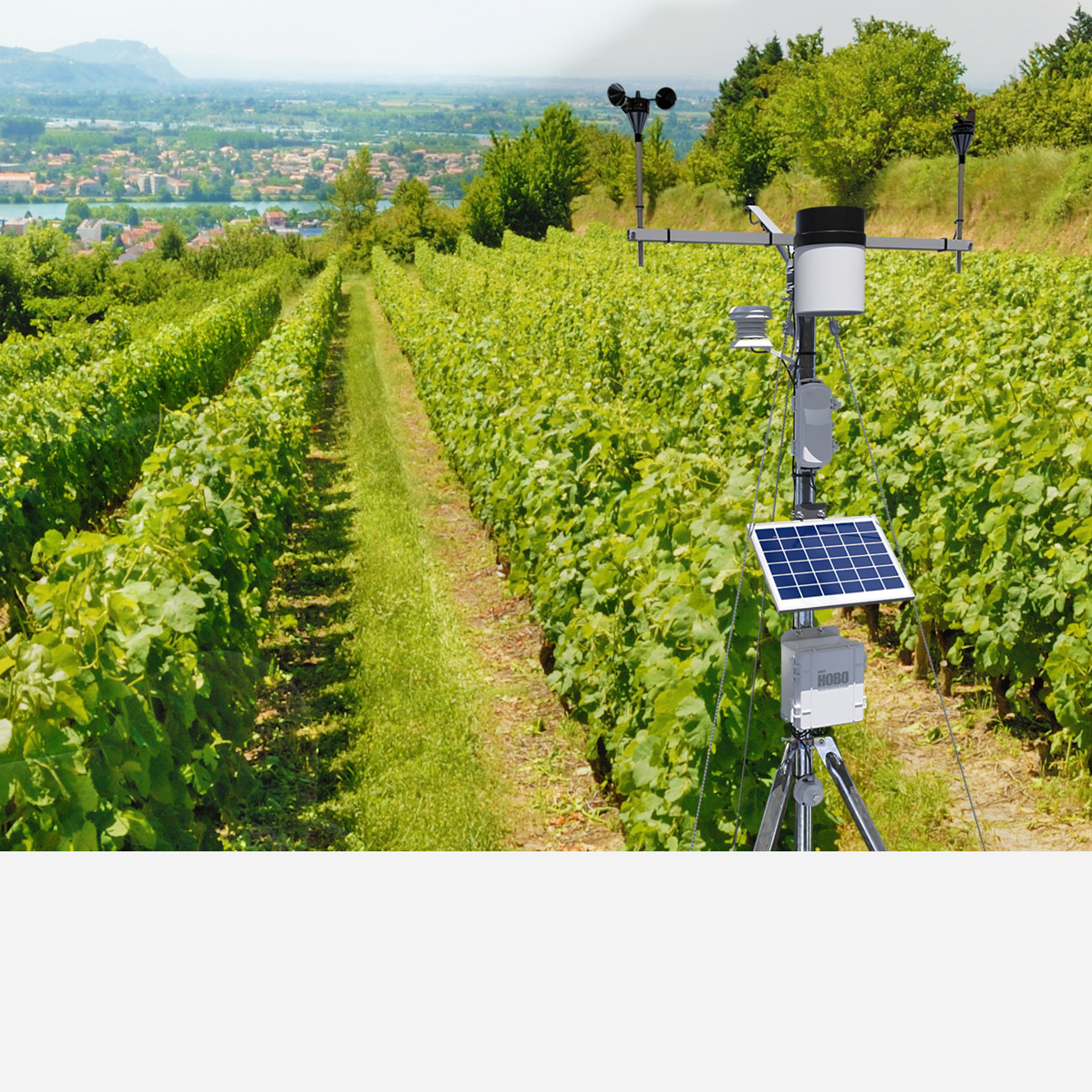
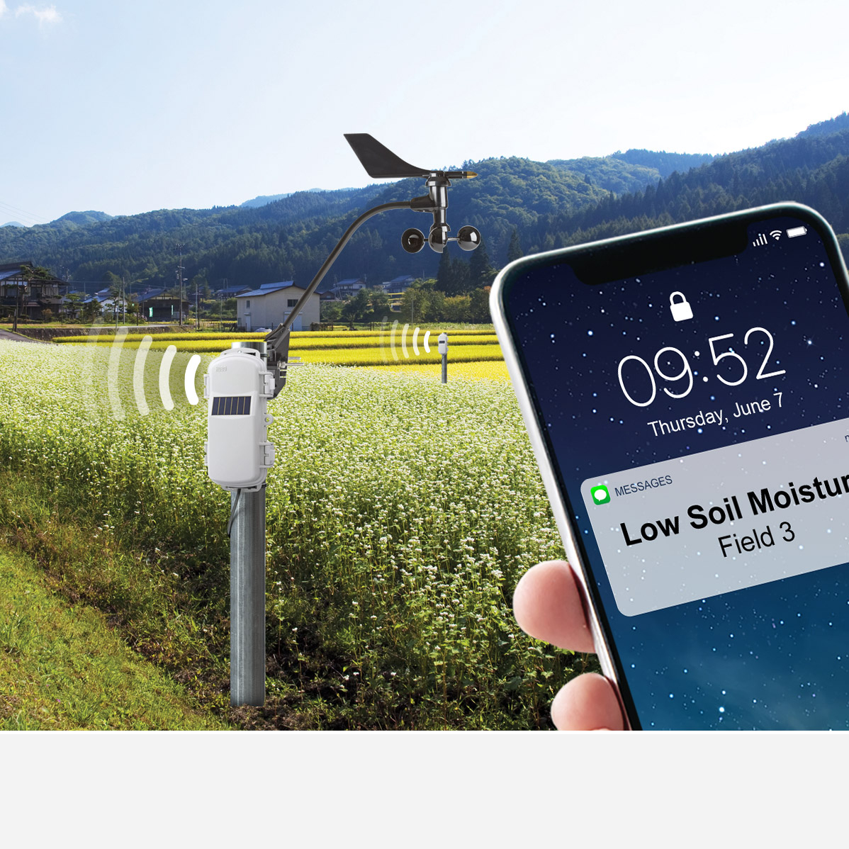
Combining easy-to-deploy, rugged HOBO weather stations with AWN’s forecasting data provides access to both microclimate monitoring data and integrated crop models.

AgWeatherNet features: |
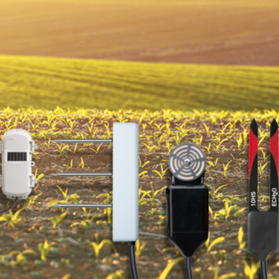
HOBO Weather Stations feature: |
|
Access to raw weather data from the Washington State University weather network |
Reliable weather monitoring with low-cost annual data plans |
|
Insect, disease, disorder, and horticultural models |
Alarm notifications via text or email |
|
WSU Decision Aid System (DAS), a web-based platform designed to transfer time-sensitive information to decision makers in the tree fruit industry |
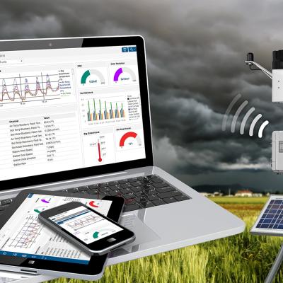
24/7 data access via HOBOlink cloud software |
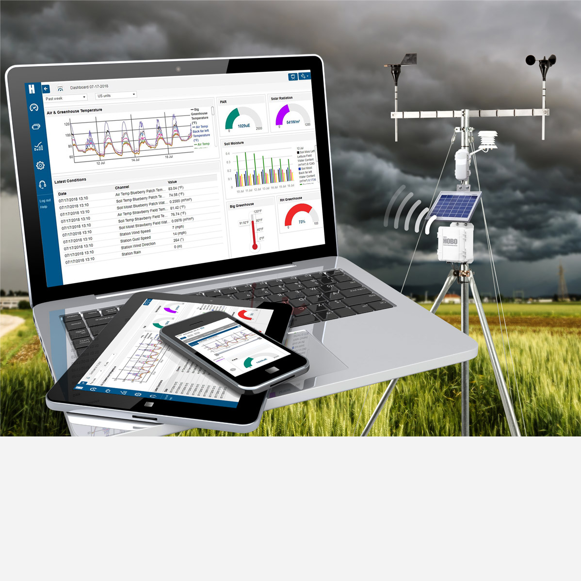
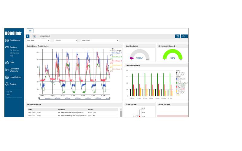
Configure your HOBO weather station with HOBOlink
Contact Onset’s Technical Support team to request API access
Provide information to AgWeatherNet’s Technical Support team at [email protected]
Highly configurable, our starter kit gives you the foundation to customize a system that's ideal for your farm. Our sales team is happy to work through your unique needs and select products that meet them. For example, we might want to consider wireless sensors to help map true temperature of apple trees on an orchard, or detect potential freeze points for bogs. We can also leverage these wireless sensors to provide soil moisture mapping throughout a berry farm.
Currently it is not. However, AgWeatherNet does allow you to display your soil moisture data in its interface, and of course you can always access it through HOBOlink.com to view, alarm, or export this information.
Soil moisture data can help you determine the ideal time for seeding and planting. It can also assist in cases where you may have varying landscapes and irrigation management is critical to optimal production.
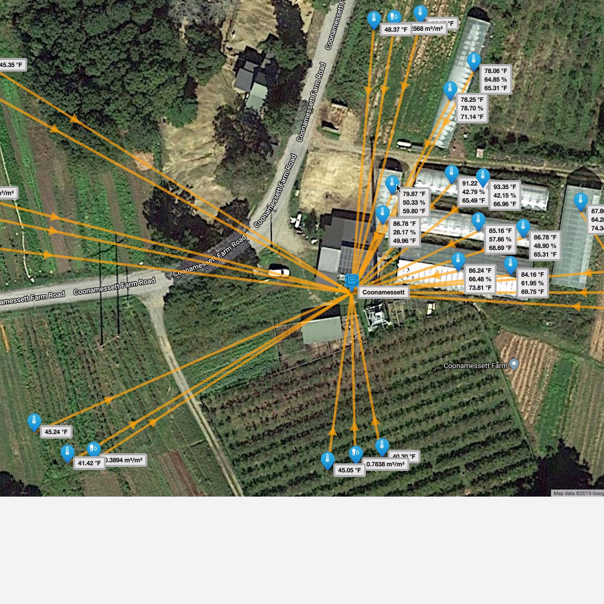
In September, 2023, AWN reached an agreement with Onset to acquire data directly from HOBOlink, with the station owner’s permission, as part of its Tier 3 private station program. AWN initiated its Tier 3 program in 2020 to incorporate approved private weather stations into the network of AWN-maintained stations (Tiers 1 and 2) and federal government stations (Tier O).
Participant benefits include:
Site-specific application of AWN decision support tools via weather.wsu.edu
AWN data management
AWN Quality Assurance & Quality Control processes
AWN site-specific weather forecast (currently under development)
By default, Tier 3 stations are open access for all AgWeatherNet (AWN). Accessibility is no different than that for AWN-maintained stations. Private station owners can opt for restricted access to their stations on AWN platforms. For restricted access stations, AWN generates a station-specific key code that the owner and those they designate can use to access the station.