
Overview
During the past 40 years, many underground coal mines throughout the Appalachian region – mainly in West Virginia, Pennsylvania, and Maryland – have closed due to a variety of factors. These include mining out of coal reserves, closure of steel mills, and more stringent environmental regulations such as the Surface Mining Control and Reclamation Act of 1977 (SMCRA).
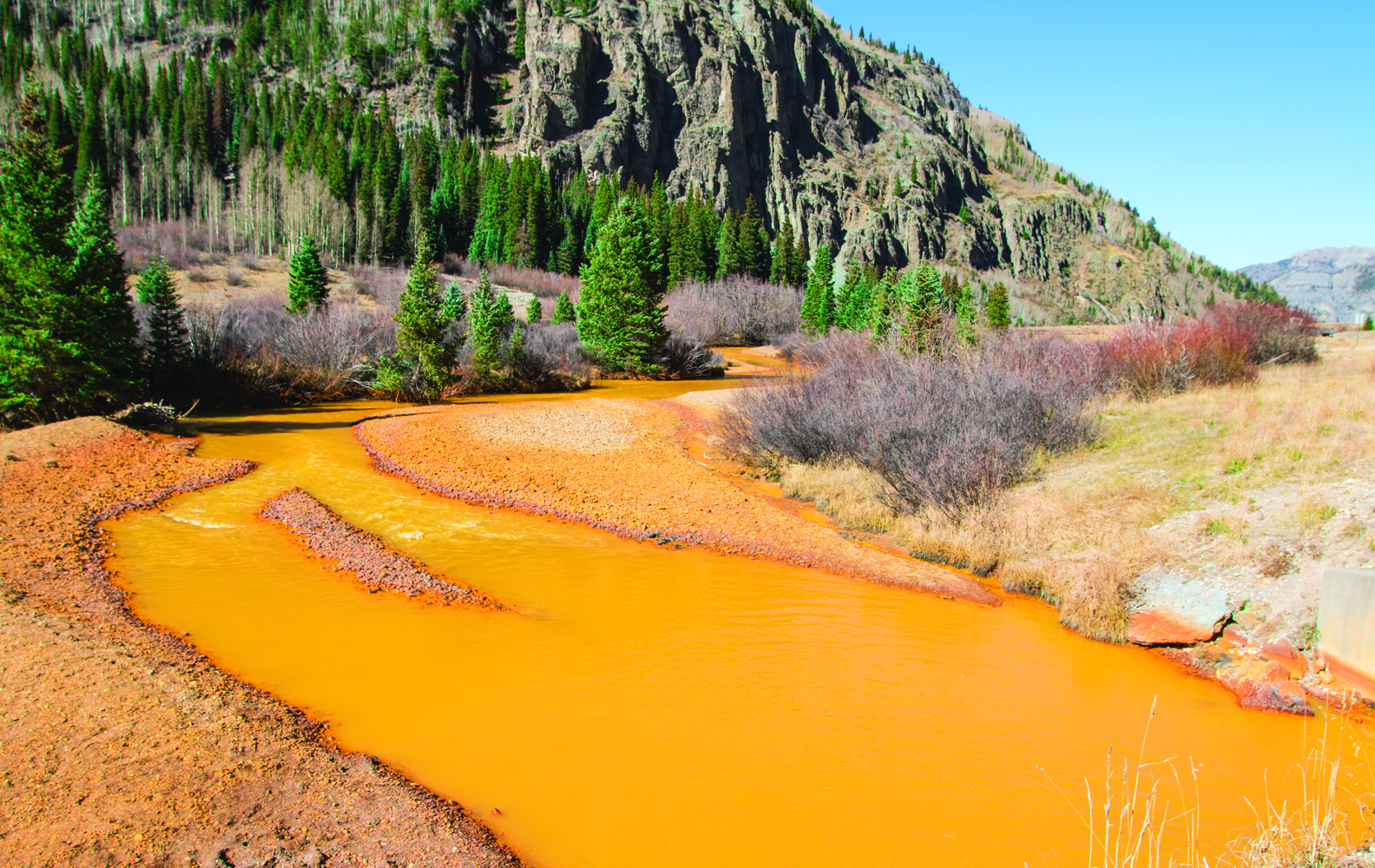
One of the key coal seams in the region of northern West Virginia/southwwestern Pennsylvania is the Pittsburgh seam, which extends from Pittsburgh, PA south to the Clarksburg, WV area and west into Ohio. The Pittsburgh coal once fired the blast furnaces of the coal industry and, more recently, generates electric power for much of the Middle Atlantic region.
While mining is still very active today, the number of active mines in this seam, which was once more than 1,000, has dwindled to fewer than 10. Many mines have shut down and have filled up – or are in the process of filling up – with water.
Hydrogeologists from West Virginia University (WVU) have been investigating the mines of the Pittsburgh coal basin since 1998 to help answer a number of questions, including where mine water is, how it is being or may be treated, and where new discharges are likely to occur. The information is helping industry, state government, and local remediation groups to better understand and plan for the impacts and risks of mine water discharge and provide early warning for potential problems.
Challenge
To accurately locate mine pools and discharges, WVU researchers needed a way to continuously monitor water levels in wells penetrating the coal despite highly-corrosive (acidic, sulfate-, and in some cases methane-rich) water conditions and alternating hot and cold conditions. The team needed instrumentation that could not only withstand the harsh conditions, but would also have enough battery power to last for multi-year deployments.
With funding from the U.S. Department of Energy (DOE), the WV Department of Environmental Protection (WVDEP), the Environmental Protection Agency (EPA), and coal operators, the team was able to purchase a number of vented water level loggers for the project.
“Initially, we were using vented-style data loggers, but they were quite long and cumbersome to be deployed anywhere up to 800 feet below surface,” said Joe Donovan, director of the Hydrogeology Research Center at WVU. “The length resulted in a lot of power loss, and we were changing batteries every two months. Plus, as flooding proceeded, we had to store a large part of this bulky cable at the surface or in wells. It got to be a real mess.”
Donovan adds that cold weather had led to condensation issues within the loggers and sensors, despite having tried various desiccant combinations to reduce excessive moisture. Failure of sensors, and in some cases loggers, due to moisture was a common occurrence.
Solution
With these limitations, the WVU team set out to identify alternative water level data logging instruments. They began experimenting with HOBO® U20 Water Level Loggers from Onset, a Massachusetts-based manufacturer of portable data loggers and weather stations.
Unlike the previous loggers used, which relied on bulky vent tubes and desiccant packs, the HOBO devices feature a sealed, non-vented design to make logger deployment in the basin faster, easier, and more maintenance-free. The loggers also feature a USB-based optical interface for high-speed offload of the collected data in wet environments. The optical design also eliminates the need for failure-prone mechanical connectors found in many traditional water level logging instruments.
To prepare the 30+ loggers for deployment, they were first connected to the research center's computer via USB cable, and configured in a matter of minutes using accompanying HOBOware® Pro graphing and analysis software. Once configured, the loggers were submerged in monitoring wells using bulk 3/16" stainless steel cable attached to hanging bolts. According to Donovan, readings are taken every hour around the clock and synced to a uniform time base.
"The loggers are programmed to record absolute pressure at hourly intervals," he explains. "The accompanying HOBOware software subtracts barometric pressure from absolute pressure recorded in the well, and then converts the pressure reading to sensor submergence. The sensor submergence is added to the sensor elevation yielding the mine-water hydraulic head elevation."
The loggers are offloaded periodically so data can be analyzed. Depending on the particular well site, data retrieval may occur weekly, monthly, or every few months. Donovan says it really depends on who is consuming the data, and that in general, regulatory agencies like more frequent reporting of results.
To retrieve the loggers for data offload, the loggers are lifted up from the sensor elevation in the monitoring wells to the surface using a casing-mounted spool. They are then reconnected to the computer and the data are downloaded into HOBOware for export to a custom data management system Donovan and his team developed for processing data. Once the data is offloaded, the loggers are lowered back into the wellbore at the same elevation to continue monitoring.
"The much lighter stainless cable is a fraction of the weight and cost of the old vented logger cable, and coated with vinyl for safety," he said. "Plus, if we need to raise or lower the sensor elevation, we simply cut cable or splice in new cable. It's absolutely simple to work with, in comparison."
Results
Since deploying the HOBO Water Level Loggers, Donovan, PhD student Dave Light, and other research associates have been able to identify mine pools and discharge sites in the complex coal basin, while dramatically streamlining monitoring operations. They no longer need to worry about replacing batteries every few months – the loggers operate for up to eight years on a single battery – and because the loggers do not require venting, they are smaller and easier to deploy in the monitoring wells.
"The data we've collected has shown that the Pittsburgh mine aquifer is in mid- to late-age of its flooding history, and is expected to largely equilibrate to a new steady state by the year 2015," said Donovan. "At this time, flooding will have completed on the eastern and northern sides of the basin, and there will be an estimated 41 discharges of any appreciable size from flooded below-drainage mines between Pittsburgh and Fairmont, West Virginia. Some of the discharge water is still quite acidic but many have already turned alkaline because of air exclusion induced by flooding. There is a broad range of water chemistries at play."
According to Donovan, the need to track water levels in the mine system will be ongoing.
"Continued monitoring of these wells is necessary as pumping patterns can change and affect the distribution and pressure of mine water in the flooded Pittsburgh mines," he said. "In addition, some locally pressurized portions of some coal mines have the potential to discharge to the surface if not carefully controlled. Mine water is also now being considered as a potential source of water for hydrofracking by the natural gas industry."
"We're the regional monitor for mine water levels, and we'll continue on because the story is still playing out."